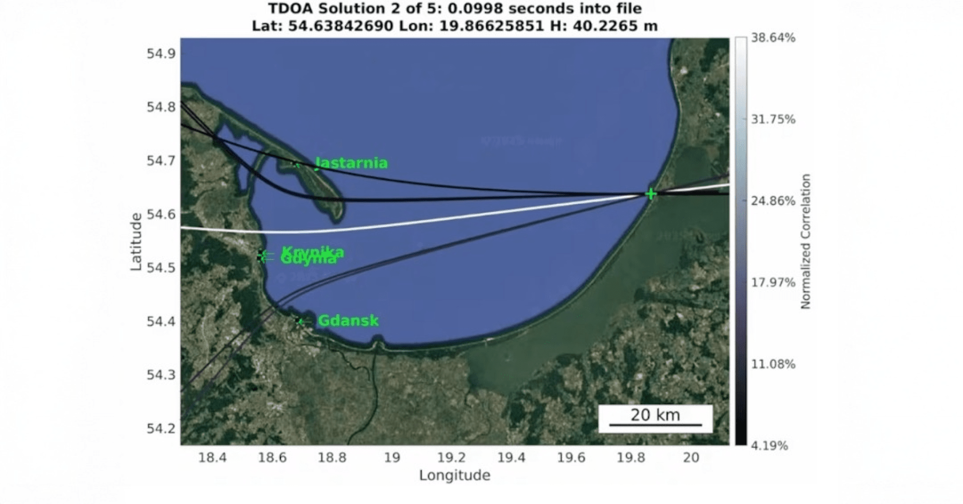
Polish scientists have traced Russia’s disruptive Global Navigation Satellite System (GNSS) interference over the Baltic Sea to coastal facilities in the Kaliningrad exclave and the St. Petersburg region, as was reported by the Defense News on July 2.
By measuring signal degradation and time-of-arrival anomalies from hundreds of flights and vessels, an international team of scientists pinpointed two primary hotspots within one kilometer of known electronic-warfare sites: the Okunevo antenna complex on Kaliningrad’s central coast and an area adjacent to the Baltic Fleet base at Baltiysk.

By 2025, Russia has increasingly favored spoofing—injecting fabricated GNSS signals—over brute-force jamming, a shift that complicates detection and mitigation efforts.
“Interfering with GNSS signals is, unfortunately, very easy,” noted Ralf Ziebold, head of the German Aerospace Center’s nautical systems department. Spoofing not only masks the presence of interference but can redirect autopilots and captains off course.
Estonia, Lithuania, Latvia, Sweden and Germany have officially branded the GNSS disruptions a form of hybrid warfare “to disrupt our lives and to break all kinds of international agreements,” as Estonia’s foreign minister Margus Tsakhna put it.
To counter these threats, Baltic states are deploying terrestrial backups such as the EU-funded R-Mode Baltic land-based beacons and the United Kingdom’s eLoran system.
Earlier, satellite imagery confirmed that Ukrainian forces struck Russian helicopters and air defense installations at the Kirovske airfield in Crimea, leaving cratered runways and destroyed radar arrays. The July 2 strike demonstrated Kyiv’s growing capacity for deep-penetration attacks, undermining the Kremlin’s regional air power.

-111f0e5095e02c02446ffed57bfb0ab1.jpeg)


