- Category
- War in Ukraine
How a Crowdfunded Ukrainian Satellite Became a Nightmare for Russia’s War Machine
Ukraine’s crowdfunded “People’s Satellite” has helped Ukrainian military intelligence identify and strike Russian military targets worth billions of dollars using radar imagery captured from orbit since 2022.
 Prefer U24 Media on Google
- Authors


Ukraine’s military intelligence agency said the country has received more than 5,900 radar satellite images through the “People’s Satellite” project since September 2022, using the data to identify and strike Russian military targets across occupied territories and inside Russia.
We bring you stories from the ground. Your support keeps our team in the field.
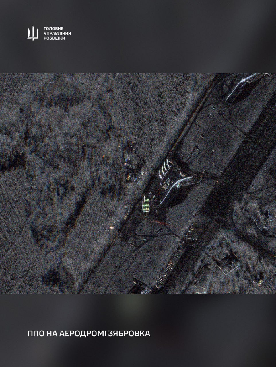
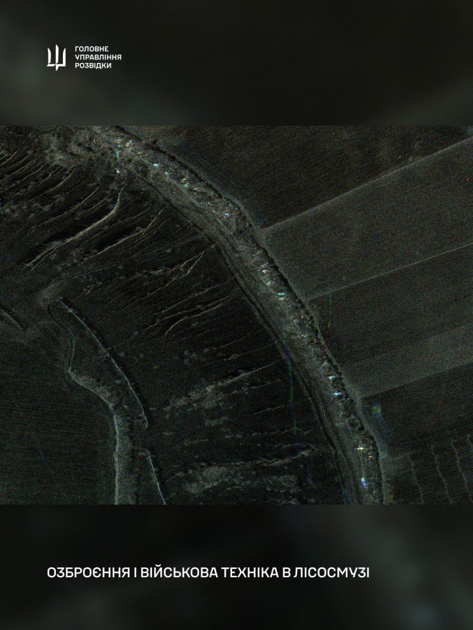
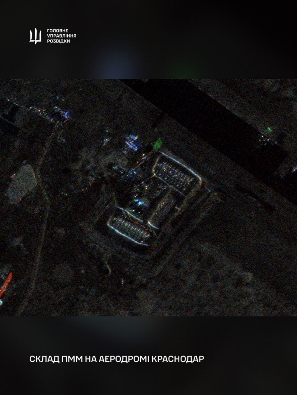
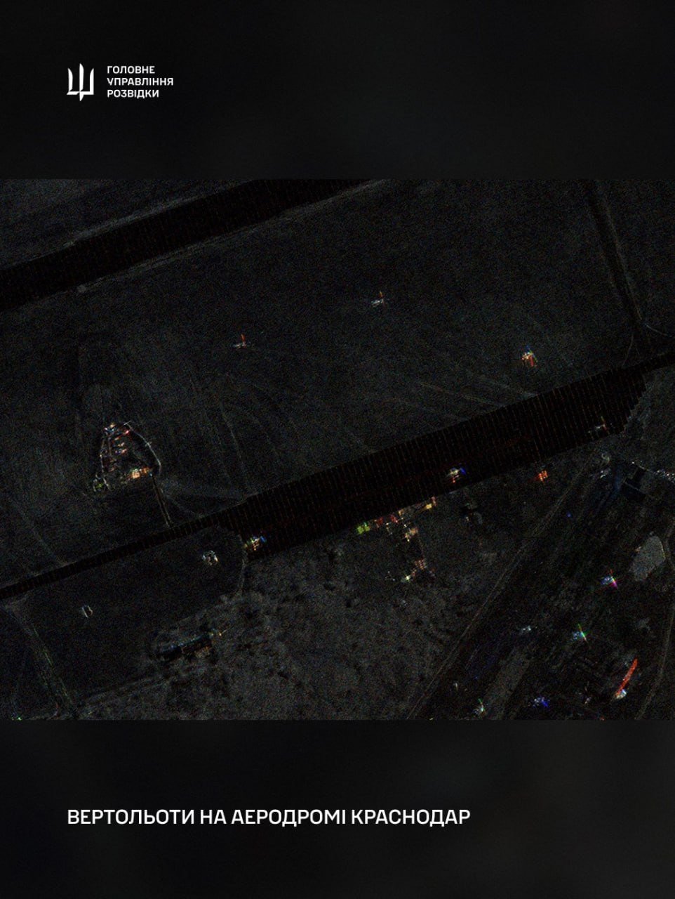
According to Ukraine’s Defense Intelligence Directorate (HUR) on May 27, the satellite imagery has supported the detection of military infrastructure, air defense systems, aircraft, fuel depots, naval assets, and other targets used by Russian forces. The images are also used to assess the results of Ukrainian strikes.
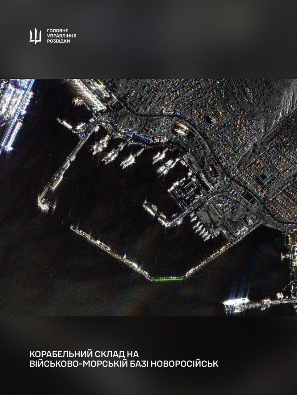
HUR released a series of radar images showing Russian military facilities, including the Olenya air base, the Zyabrovka airfield, fuel storage sites in Krasnodar, air defense positions, helicopters, and naval vessels near Novorossiysk.
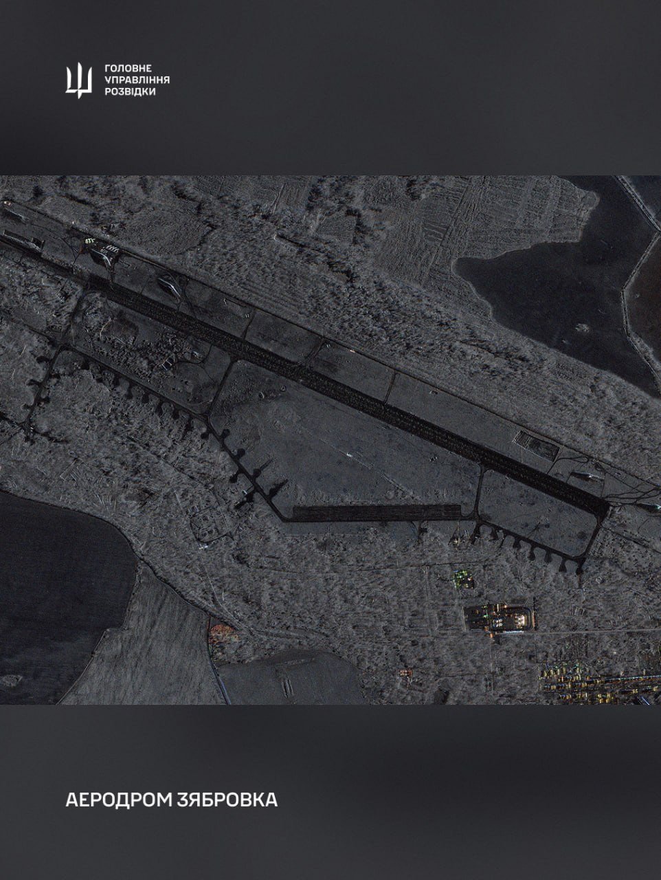
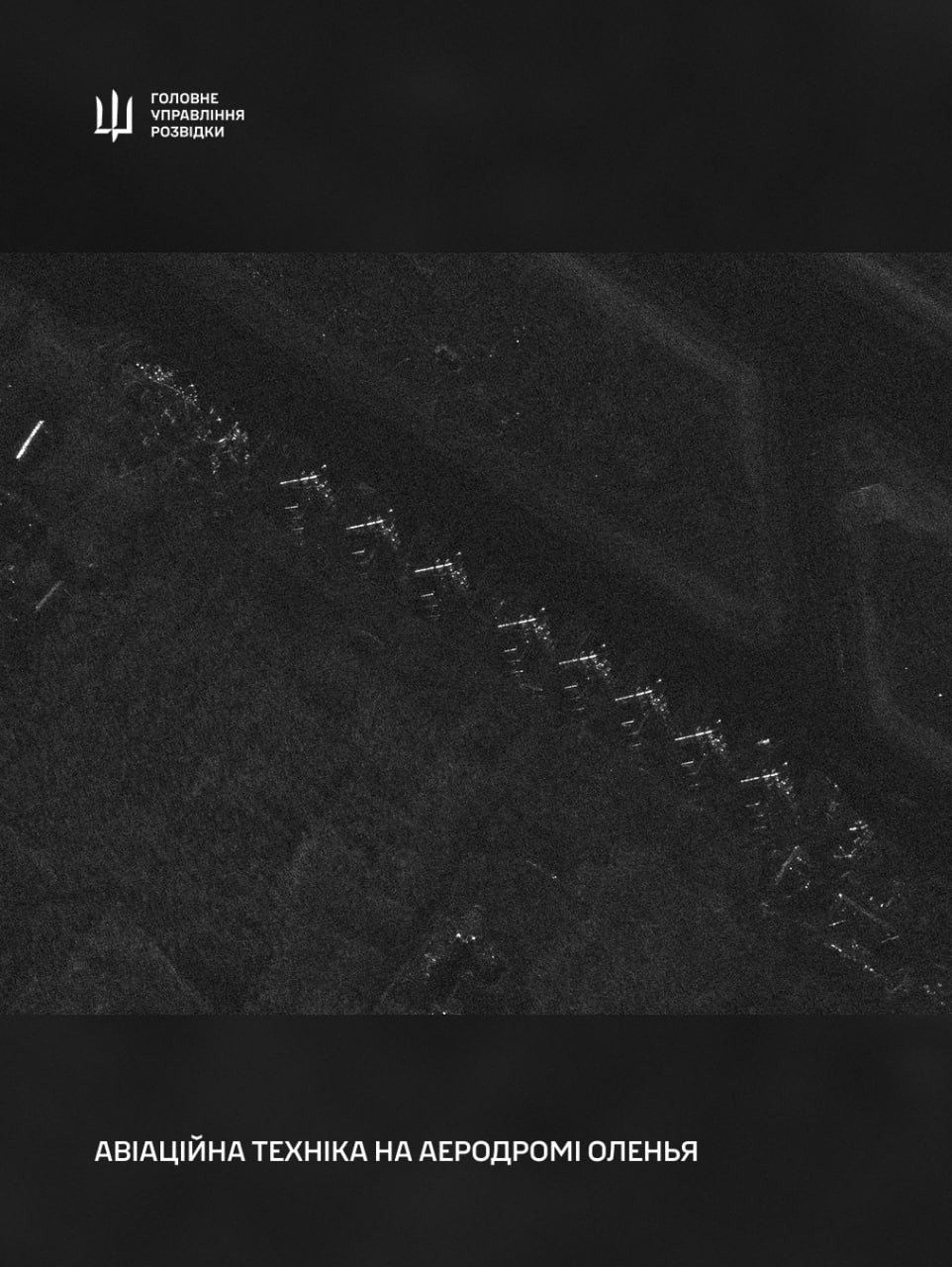
The intelligence agency said the data is provided through the “People’s Satellite” initiative launched in 2022 by the Serhiy Prytula Charity Foundation. Under the project, Ukraine obtained access to a satellite operated by Finnish aerospace company ICEYE, along with access to imagery from the company’s broader SAR satellite constellation.
Ukraine’s “eyes in orbit”
According to HUR spokesperson Andrii Yusov, the satellite has become an important component of Ukraine’s battlefield intelligence capabilities.
“For modern warfare, access to space technologies plays an extremely important role, and the ‘People’s Satellite’ became Ukraine’s first sharp eyes in orbit—we see where to aim, we understand what is best to strike with, and we have control over the consequences of strikes. The multi-billion-dollar losses of the Russian aggressor are among the results, including those of the ‘People’s Satellite,’ and this systematic work continues,” Yusov said.
How the satellite works
HUR stated that the SAR—synthetic aperture radar—technology used by ICEYE satellites allows operators to obtain imagery regardless of weather conditions, cloud cover, or time of day. According to the agency, some images can reach a resolution of up to 0.25 meters per pixel, while a single image may cover an area of up to 225 square kilometers.
The “People’s Satellite” project was funded using money originally raised by Ukrainians in 2022 for the purchase of Bayraktar drones.
After Turkish manufacturer Baykar provided the drones free of charge, the funds—reported at 600 million hryvnias—were redirected toward acquiring satellite capabilities for Ukrainian military intelligence.
At the time, representatives of the Serhiy Prytula Foundation said Ukraine had previously relied on satellite data provided by international partners, often with delays. Direct access to ICEYE systems reduced the time needed to transfer imagery to Ukrainian military units to several hours.
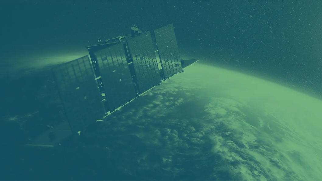
According to information previously released by the foundation, the satellite passes over Ukrainian territory twice daily, while access to imagery of Ukraine remains exclusive to the Ukrainian side as the satellite operator.
HUR also noted that SAR imagery can help distinguish real military equipment from decoys and identify concealed objects, including vehicles and shelters hidden in forested areas.
Earlier, ICEYE founder Rafał Modrzewski said Ukraine’s Defense Forces use the company’s radar satellites to monitor Russian troop movements in near real time, with the ability to capture up to 20–24 images of the same target daily. Modrzewski said ICEYE continued supplying satellite data to Ukraine even during temporary restrictions on other Western satellite services.
Discuss this article:
-9a7b3a98ed5c506e0b77a6663f5727c5.png)

-c439b7bd9030ecf9d5a4287dc361ba31.jpg "Photo of Katherina Popilnichenko")

-29a1a43aba23f9bb779a1ac8b98d2121.jpeg "Photo of Illia Kabachynskyi")